A Rich History Revealed through Excavation
Five miles south-east of Dorchester lies the parish of Poxwell, an L-shaped area occupying the south-facing slope of a spur of chalk downland on the 4oo-foot contour. This slope forms the north side of a valley that denotes the line of the Poxwell fault, a dislocation of the strata that brings the Chalk on its north side against part of the Purbeck Beds to the south. Since the Dorset Ridgeway, a major line of communication for trade in prehistoric times, runs close to the parish boundary, the area is rich in the remains of associated settlement and cultivation in the form of strip-lynchets, enclosures, burials, and “Celtic” fields. (see the feature Dorset Ancient Fields published 10th of April 2011 in the General Category.)
An early survey by the RCHM found both Celtic field and Medieval strip-lynchet systems to be present within the parish. In 1967 trial excavations were carried out by Mr H C Bowen at the behest of the owner of Poxwell Manor Farm, Mr J H C Lane, when the latter decided to level a system of lynchets in the vicinity of the manor grounds. This excavation revealed occupation debris and stone features which necessitated a larger-scale excavation being conducted. This was undertaken by J S Wacher in 1968.
The excavation further revealed fragments of probable Kimmeridge shale, used for ornamentation in prehistoric times, and some fibrous calcite (calcium carbonate) similar to the satin spar variety of Gypsum (calcium sulphate). As the dig progressed it became clear that a composite stratigraphy representing five periods was emerging. The layers and features were placed with regard, not only to their stratigraphic position, but also to the date of the associated pottery and any dateable attributes of the features. These periods were – (1) ?LATE NEOLITHIC – EARLY BRONZE AGE; (2) IRON AGE (c 400-c 150 BCE); (3) ROMANO-BRITISH (earlier phase c 200 CE/later phase 275-300 CE; (4) c 300 CE (1st HALF of 4th CENTURY; (5) SECOND HALF OF 4TH CENTURY & LATER.
Of these five periods the Romano-British (3) was by far the richest and most complex regarding evidence of occupation remains. It is by a fortuitous fluke of nature the site has been well preserved. The terracing of the slope played a part in this, but ironically it was Medieval ploughing that contributed towards further protection. The north-south orientated Celtic field lynchet just west of the site was drawn across it when the east-west trending lynchets were established. Later hill-wash also contributed to this effect, but beyond the lynchet system features, including a burial, have been disturbed.
Beginning with Period 1, NEOLITHIC TO EARLY BRONZE AGE, this is based mainly on the position and posture of a skeleton in a shallow grave near the corner of what appeared to be a Celtic field, though this is now much obscured by later strip lynchets. The position of this grave and the crouched attitude of the burial suggests that it may originally have been covered by a barrow or tumulus of earth. Barrows are commonly sited in association with such field-systems, though it is often difficult to establish which came first. The grave contained a layer of silt at the bottom, a feature suggesting that the pit may have been open for some time before the dead person was laid out and the grave back-filled. Subsequent Romano-British terracing of the slope may explain the absence of any associated ring-ditch around the grave; no other contemporary features or finds were noted, except possibly some flint chippings.
Evidence of remains datable to the IRON AGE (400-150 BCE) were also sparse, again probably due to later terracing on the slope, and only one large pit could be assigned to the period with any certainty. On the floor of the pit a layer of silt was overlain by a layer of chalk rubble, possibly derived from the rim and sides of the pit. The presence of charcoal pointed to the pit having originally had a wickerwork lining. Clay was also present, and these provisions suggest that that the feature had been dug for use as a grain silo (similar material has been found in known storage pits of the period). The clay was explained as the remains of seals to the pit. Above this the next later was of stone rubble, a feature that may have been purposely added to raise the level enough for a corn-drier to be constructed. Carbonised grain and fragments of charcoal were identified from a layer within the corn-dryer and above was a layer of brown clay with largish stones, which may have been part of the oven wall before it collapsed. Besides this pit there was one other, smaller pit to the north of the first which also featured a layer of carbonised material but which, unlike Pit 1, yielded no sherds of Iron Age pottery, suggesting that it should be assigned to Periods 1 or 3 in its dating.
Period 3: ROMANO-BRITISH
This period involved two recognised phases: (earlier; 200 AD & later: 275-300 AD) Pottery sherds are notably more common during these two phases, perhaps as the result of hill-wash or material being re-deposited by mechanical disturbance. As regards features, the period was one that amounted to considerable industrial activity, to judge by the remains of ovens, walling, plinths, paved floors, and a drainage gulley. Furthermore, interments are represented on the site by a twin burial of an adult woman and a child, a grave that indicates by its shallowness that it dates from before the later terracing operation and indeed the accompanying pottery indicates a date of around c150 AD. Consequently, it is thought that the grave does not belong to the main period of activity on the site. Another burial close by produced no evidence which could date it with any certainty, though its similar alignment to the woman-child interment suggests that it is contemporary with the latter. Stratigraphic evidence does not contradict this, but equally it cannot be used to confirm it.
It is clear that activities of an industrial nature were planned for the site, though there is some doubt as to whether they were ever of continuous duration. The evidence of the pottery and stratigraphy seem to point to a process of unsuccessful experimentation having been undertaken, and so it is likely the site was occupied only for a short time. The complex of ovens and other features were set out against a sheltered corner formed by the base of two slopes, one running north-south, the other east-west, meeting at right- angles. Occupying the south-west corner of this shelter was an oven containing a residue of charcoal and ash, but as to its exact purpose this remains unexplained.
Situated further north, and positioned just behind the first burial, was a horseshoe-shaped oven lined with regular rectangular stones and opened towards the east across a shallow oval depression. A closer examination showed that this was not in fact a single structure but two layers of walling, suggesting that two ovens were present, a later one comprising finer stonework being superimposed upon the earlier outer layer. From the design it was thought that this had been a smelting or roasting furnace of a type found on a contemporaneous site at Broadmayne. The earlier oven was built into a pit excavated in the chalk and was approximately three feet in diameter with four surviving courses of stone. A number of loose blocks lay on the floor of the structure, having evidently collapsed into it from higher up, suggesting that the oven may have originally stood about three feet above the present ground level. Against the back of the oven there was a heaped deposit of unburnt greensand with only a few burnt patches. Behind this deposit the back of the oven showed no sign of burning, which showed why the oven space was reduced by the introduction of another layer of walling, partially overlying the earlier firing up of the oven. It has been presumed that this modification was intended to overcome the problem of insufficient heat being generated in the earlier furnace; reducing the inner diameter by 25% overcame this, but it appears that success still eluded the workshop as shown by the complete absence of any industrial slag.
Greensand, however, contains a silicate of iron called glauconite, which thus enables it to be used as a low grade iron ore. There is therefore some possibility that iron was being smelted by roasting greensand in the oven, in which case, the absence of nodular slag would be explained. Yet even if roasting was being undertaken the shortage of residues from the process leads one to the conclusion that the workshop must have been in use only for a brief period.
The greensand deposit on the floor of the inner oven was overlain by a layer of charcoal with much greensand mixed in with it, particularly near the sides. Similar material was found filling the stokehole. That temperatures of the order required were attained in the new smaller oven is shown by the existence of vitrified clay, a probability that is further supported by the cracked and fractured condition of the limestone walling. A better distribution of heat was therefore obtained after the original oven had been reduced in size. Conveniently it was this damage which rendered the stone blocks worthless as robber-material after the site had been abandoned, so enabling them to survive while the rest of the site was pillaged for stone after the end of period 3. A greensand dump lay close by the ovens directly upon the native chalk. This was certainly an indication that terracing had occurred, and further, that the outer oven at least is contemporaneous with the earliest use of the freshly terraced site. The pottery associated with the construction of this oven is critical to the chronological framework of the entire site. The upper fillings of the stokehole and furnace of the inner oven yielded datable pottery indicating the latter phase of Period 3.
A fourth oven was found in the north-west corner of the terraced platform, abutting against the exposed bank of the chalk. This position would likely have had the effect of insulating it against heat loss, but the oven’s walling had been so extensively robbed-out that very little remained, these being portions of the northern and western base walls, and two large slabs. These slabs may have been floor-stones, and their thickness would have suited them to this purpose, as it would have meant that the grain would only have been exposed to a gentle amount of heat. Yet there was a burnt layer of considerable thickness, with carbonised grain and charcoal at the base of this furnace, pointing to the occurrence of a conflagration of some description centred on this corn drier. The chalk forming the back wall of the drier above the line of the stone walls also displayed burn marks. Possibly there was a timber cover to the oven that caught fire, carbonising what was inside.
A few yards to the east of this oven and abutting onto the south-facing slope of the lynchet a fifth oven had been constructed. In its plan this structure showed that an attempt may have been made to improve on earlier efforts. But from a stratigraphic point of view it is equally likely that these two corn-drying kilns are contemporary. This oven was slotted neatly into a square-ended recess at the base of the lynchet at the north end of the site. But in this instance the pattern of the flues could easily be made out, these being in the form of a tuning-fork or perhaps an H shape. The flues consisted of limestone and chalk with chalk rubble filling in the space around them. Nothing of the floor remained, nor were there any signs of burning or carbonisation. From this it was concluded that this corn dryer was hardly, if ever, used. A short way to the south of the dryer a small portion of walling no more than two-thirds of a metre in length was excavated, though whether this was a very small remnant of another part of the oven which had survived robbing, or an entirely unrelated feature, was not determined with certainty.
What then, were the industrial activities formerly carried on across this site established to serve? Clearly the five corn-drying kilns and their associated structures or features constituted a workshop that became derelict around the end of the third century, yet it is highly unlikely that it could have functioned independently as a unit unattached to any parent organisation or market outlet. Rather, the site is best interpreted as a workshop or shelter for workers employed on an associated Romano-British villa estate who’s remains have not yet been found. If this is the case, then the short period of occupation so evident in the remains suggests that the workshop formerly occupied marginal land at the edge of an estate it served, so indicating a peak of prosperity for the villa, a time when the land was used to its maximum agricultural potential. In this respect the location of the industry could not have been more ideal, for it was situated on well-drained chalk above the spring-line, providing the workers with a source of water supply which is even marked by two wells to this day. Further, it was tucked away into the corner of a right-angled turn in a positive Celtic lynchet and, incidently, faced east, affording the structures protection in the lee of the south-westerly winds regularly sweeping up from Lyme Bay.
Only one coin was ever recovered from this site, which dated the activity to the late third century. The brief occupation of this period (3) is attested to by the virtual absence of pottery and by the fact that no occupation layer was associated with the structures. As described earlier,the alteration of the composite (double-walled)oven and the absence of slag and hammer-scale points to little success in carrying out the industrial processes. Further, there seem to have been considerable problems with the corn-dryers; one may have burned down and the other seem to have been barely used before it was abandoned. As a result of the difficulties encountered the site was abandoned after a short time, though it has been thought that the desertion could equally have taken place because because the peak of prosperity had passed and it became no longer economic to cultivate the marginal land of the estate. After dereliction most of the stonework was robbed out.
Period 4
Corresponding to 300 AD to around 360 AD, by contrast with the preceding period, produced significantly more small finds and pottery sherds. It evidently followed on from Period 3 without any noticeable hiatus or break, since no turf line separates the two layers. Period 4 is represented by a thick layer radiating from the oven near the right-angle turn of the lynchet in the north-west corner of the site. This layer was seen to thin out towards the south and east, it source being apparently domestic, since quern fragments, appropriate pottery and plentiful food waste were present in the deposit. It has been thought that this waste material may have come from a midden associated with a nearby farmstead or villa that could have occupied the site of the present village of Poxwell. The small find seem to support the idea of a domestic source, as small structural fittings and domestic artefacts are also present. To judge by the amount and nature of the finds it may also be inferred that the site became a midden – ie a dump for domestic waste. The waste not unnaturally contained animal bones of sheep, oxen, horses, pigs and geese; furthermore, shells of winkles, oysters and limpets show that seafood was also a part of the diet. Other than the burials of two infants, no graves of adults were observed; the skeletons were largely intact and had not suffered from the attention of scavengers. In choosing this area to use as a midden, the intention may have been to reclaim it for agriculture in the future. More likely though, the intention was to way-lay the collapse or subsidence of nearby lynchets into the disused cavity.
Period 5
The second half of the fourth century and later, which is covered by this period, was represented by a layer of variable thickness that extended over the whole site. This layer was a chalky loam which contained some flints and appeared to be a secondary deposit as the result of hillwash, since the inclusions were erratics (fragments derived from another area).
The POTTERY
As stated previously, there were no finds of ceramics made from the layer corresponding to PERIOD 1, though collectively from PERIOD 2 onwards some pottery was in evidence. Later Romano-British terracing operations however had effaced almost all artefacts dating from this period, so that little that did remain was likely only a fraction of what once existed. Three distinct types of fabric were identified.
A small quantity of pottery was associated with PERIOD 3, which covered all Romano-British activity until the site became a waste dump in Period 4. One of the burials of the period contained a high amount of Iron Age pottery in the backfill, together with a grooved rim bowl of a type found at Dorchester dated to 150 AD. Pottery associated with the later Romano-British features and connected with the use of the site was indeed singularly lacking.
Following the robbing of the site at the end of Period 3, there is a notable increase in the volume of pottery and other artefacts from the Period 4 layers. There is also a notable increase in the size of the sherds, which had once belonged to jars with rims having a greater diameter than the body. Flanged bowls make their appearance, several of which were coated in a white slip. The period further saw the introduction of some New Forest wares, which began to be produced around 300 AD.
The pottery from Period 5 differs little from the nature of the wares encountered in Period 4. There were similar wide, overturned-rim jars, unadorned bowls bearing flanges dropped well below the rim and plain,rimmed dishes. Besides these however, there were more unusual forms present. For example, one of the bead-rimmed jars seems to be reminiscent of an Iron Age type; another, although a similar form, was made in a coarse fabric more usually characteristic of Iron Age pottery. Other elements in the ceramic assemblage were storage jars of the New Forest industry type, as well as NF bowls, beakers and parchment wares, with just a very small amount of Oxford ware. This means that the same pottery industries as were found in the Period 4 finds were also found here, though as with the former they do not appear to represent any later developments.
OTHER ARTEFACTS
Besides the pottery, some iron, copper and lead objects were recovered from the site. Period 4 was also notable for fragments of prismatic mould-blown glass bottles of a type that are very common on Romano-British sites of between the 1st and 3rd centuries, and for half a bracelet with incised decoration. A stone axehead and a bronze coin of Tetricus 1 (270-3 AD) were also found in the Period 4 layer.
A NOTE ABOUT THE TOPSOIL
This produced a small amount of Medieval pottery, confirming that there was some settlement of this period in the area and complimenting the presence of the strip lynchets.
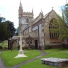
Beyond the borders of the site, prehistoric (Bronze Age) occupation in the parish is represented by the presence of a cairn circle (probably the internal sepulchre of an earthen round barrow since eroded away)
half-a-mile south-east of Poxwell Church.