Dorset Ancestors Rotating Header Image

Isaac Gulliver

Sixpenny Handley

The hundreds of Sexpena and Hanlega were amalgamated probably in the 14th century and became the Hundred of Sixpenne et Henle. The parish was formed in the 19th century when two chapelries, Handley and Gussage St. Andrew, previously parts of the parish of Iwerne Minster, were united.  However, Handley had been a parish until the 13th century.

Until relatively recent times the village was known simply as Handley. It lies in the eastern part of the parish, comprises over six thousand acres and spans the upper reaches of three valleys in the north-east of the county. This is the largest village in Cranborne Chase and it is the economic heart of the parish. In the west of the parish are the early settlements of Minchington and Gussage St. Andrews, where two later settlements appear to have sprung up: Woodcutts, in existence by 1244 and Dean, in existence since 1278.

The Parish Church of St. Mary is at the north-west end of the village. There are pointers to a 12th century building: a stone carved image of Christ-in-Majesty; the font and a capitol re-used as a stoup in the porch, but nothing else from that period has survived. The chancel and the south porch date from the 14th century and a north aisle was added in 1832. In 1877 the 14th century porch was taken down and re-erected in its present position and a south aisle was built on. At the same time the nave, north aisle and west tower were rebuilt. Amongst the monuments in the church is one to John Alie, who died in 1579, and his family; there is a brass commemorating the life of James Isaac, the parish clerk whose family held that position for a 128 years including throughout the 19th century.

 Isaac Gulliver, the notorious smuggler, used Handley as one of his bases and it was at St. Mary’s Church that he married Betty Beale on the 5th of October 1768. A newspaper in 1770 reported that a posse of the Excise men came to the village and seized contraband tea and brandy hidden in a cottage in the village; they had to beat off an attack from local free traders and managed to get the contraband safely back to the Excise Superintendents house in Blandford.  Later in the evening about 150 men armed and on horseback came to Blandford and persuaded the Excise officer’s wife at gun-point to give them back the contraband. (See our story: Isaac Gulliver – Dorset’s Smuggler King, published 24th April 2010 in the Real Lives category.)

The village sits in a part of the county where there are many prehistoric remains. Local land owner General Pitt-Rivers was responsible for much archaeological work in the area, notably at Wor Barrow, a Neolithic long barrow about a mile to the east of the village and at a site on the common near to the hamlet of Woodcutts. More recently Bournemouth University has carried out a considerable amount of work hereabouts. (See our story: General Pitt-Rivers & the Cranborne Years, in the Biography category, published 19th November 2012.)
 
A fire in 1892 destroyed most of the village; inevitably most of the buildings along the long High Street are modern and include several shop premises. Within the parish boundaries however, there are several examples of attractive houses dating back to the 16th, 17th and 18th centuries. This is not a picture post card village but whether or not it still deserves Frederick Treves accolade of “..the ugliest village in Dorset,” is something you will have to make your own mind up about.

(See our story Sixpenny Handley – the Fire of 1892, published 2nd December 2012 in the Sixpenny Handley category.)

Chettle

In the north-east of the county at the head of a valley in the Cranborne Chase lies the parish of Chettle. The village lies at the bottom of the valley and was, until the 16th century, surrounded by open fields and some enclosed pasture, according to Hutchins. Recorded as Ceotel in Domesday Book, the name is from the Old English and means kettle, a reference to the location of the village in a deep valley surrounded by hills. The two Long Barrows in the parish provide cover for the remains of earlier guardians of this place from the Neolithic age, testifying to the manor’s ancient past.

This peaceful retreat has several thatched roofed cottages dating from the 16th, 17th and 18th centuries, a pretty church and Chettle House, attributed to Thomas Archer and commissioned by George Chafin MP in 1710. This Queen Anne house is in the English Baroque style and sits in five acres of gardens.

The first Chafin came to Chettle in the 17th century. The family possibly seeing its secluded location as shelter from the momentous events of those times were not shy of doing battle. Thomas Chaffin (1650-1691) left from Chettle to oppose the Duke of Monmouth at the battle of Sedgemoor, where he was Commander of a troop of Dorset Horse. He saw his share of conflict in those exciting days but he died in 1691 of natural causes at the age of 41. Thomas Chafin and his wife, the daughter of Colonel Penruddock, who was “beheaded for his loyalty” during the Civil War are commemorated in the parish church.

The Chafin family enjoyed field sports and enthusiastically enforced their rights in the Chase and this led to altercations with neighbours: in one dispute George Chaffin (1689-1766, ) MP and Ranger of Cranborne Chase, was challenged to a duel by Bubb Doddington , a fellow Member of Parliament and neighbour. William Chaffin (1733-1818) was the author of Anecdotes and History of Cranborne Chase a volume of tales about the gamekeepers enduring battle with poachers. William was said to have been an unruly man but later he became Rector of Chettle Parish. He accidentally shot a woman the first time he handled a gun.

In 1914 another William Chafin came to live at Chettle and like his ancestor he was writing a book, Anecdotes of the Cranborne Chase, when he was struck by lightning: he survived and finished his book.

Chettle House became the home of the Revd John West. He was born in Farnham, Surrey in 1778 and ordained at Winchester Cathedral in 1806. In February 1820 he arrived to take up his duties at Chettle but quickly returned to Aldershot, his previous parish. On the 27th of May 1820 he sailed from Gravesend on board the Hudson Bay Company’s ship Eddystone and landed in Red River Settlement, British North America. He joined a group of displaced Scottish crofters who had been settled there by the Earl of Selkirk.

John West set-up schools for the Indians and he was the first Englishman to preach to Eskimos, this was at a gathering at Churchill on the Hudson Bay in 1823. He made two later visits to other parts of North America, going to Nova Scotia and New Brunswick in 1825 and 1826. His Red River school and settlement later became St. John’s Cathedral, Winnipeg.

In 1828 he returned to England and settled in Chettle. He was fascinated by wanderers both in North America and at home in Dorset and worked tirelessly for them. In Dorset with help from Lord Ashley he set up the ‘Orphan Gipsy Assylum and Industrial School.’ He died on the 31st of December 1845. The 150th anniversary of his arrival at Red River was celebrated In 1970, with special commemorative services at Chettle and Winnipeg.

All that remains of St, Mary’s church from John West’s day is the 16th century tower. The chancel, nave, vestry and organ chamber were built in 1849, replacing demolished medieval buildings. There is a memorial to John West in the chancel and in the church there are memorials commemorating members of the Chafin family.

In 1846 banker William Castleman and his son Charles, a solicitor, purchased Chettle House and the parish. This Wareham family had made its money in the railway business and  they sponsored the first railway line into Dorset in 1845. The line opened from Southampton to Dorchester on the 1st of June 1847 and soon became known as Castleman’s Corkscrew because of its route. The Castleman family can trace their roots back to Isaac Gulliver, the master smuggler.

Chettle house is the principal monument and main attraction in the village. Pevsner says it is: “the plum among Dorset Houses… and even nationally outstanding as a specimen of English Baroque.” This elegant oval structure built of red brick with dressings of Chilmark stone stands in five acres of delightful gardens. In the grounds is the dower house now The Castleman a hotel and restaurant.

Footnote: Tim Edwards writes: It was Edward Castleman, who bought this house; he was the only son interested in country life. Also they had no part in the Railway, other than working for the owners as solicitors and both acted for the Company, until after the line was purchased by LSWR.


Abbotsbury – A Perfect Day Out

Where better to start a day out at Abbotsbury than at the top of Abbotsbury Hill. From this vantage-point you can enjoy breath-taking views of the Dorset coastline, but to do so safely use one of the lay-bys provided. To the west you can see over Lyme Bay and it is said that on a fine day the view is clear to Start Point, off Plymouth. The view to the east is over The Fleet Lagoon with Chesil Beach stretching across the vista to the Island of Portland. In the foreground, sitting on a hill and from here easily mistaken as nothing more than a lookout point, is St. Catherine’s chapel. This is the first of many glimpses of the chapel you will enjoy during the day.

Before descending to the village cross over the road and take a walk around Abbotsbury Castle. This is an Iron Age hill-fort on the brow of Wears Hill on the edge of the hills to the north of Abbotsbury known as the Ridgeway. The hill-fort has double ramparts, which enclose an area of about 4 acres; the whole site covers about 10 acres. The fort is seven miles from Maiden Castle and five miles from the hillfort of Eggardon.

Down in the village you will find a choice of places offering food and drink. Tuck in and enjoy, forget the calorie count; there is still lots to see and places to visit, and any surplus energy you have you will need for the final climb of the day. In the village you are spoilt by a variety of shops offering all manner of interesting goods from the usual tourist bric-a-brac to some excellent work offered to you directly by local craftsmen and artists.

As you walk through the village feast your eyes on the cottages: many date back to the 16th century or earlier. Strict planning and conservation regulations ensure they remain much as they were.

The Church of St. Nicholas is well worth a visit. It is mainly 15th century, but was rebuilt in the 16th century and restored in 1885. There is a fine embattled tower with six bells. During the Civil War the church was defended for the King, and in the Jacobean pulpit there are two-bullet holes, evidence of the conflict.

 Standing in the porch is an effigy in Purbeck marble, (actually a grave slab from the earlier Abbey church) of a late 12th century abbot. The 15th century stained-glasswork is a notable feature of this church and the panes in the north and south aisle windows are noted for their subtlety of colour. Of special interest is the second window in the south aisle which shows the delicate face of a woman thought by some to represent St. Catherine, but is more likely to be the Virgin Mary from a Crucifixion window.

A few steps through the churchyard will bring you to the site where the Abbey of St. Peter stood. From here there is another view of St. Catherine’s Chapel. Of the Abbey little remains to be seen: only one wall and the entrance arch remain standing. Sir Giles Strangeways bought the Abbey, its lands and holdings in the 16th century just four years after he had been the commissioner appointed by Henry VIII to negotiate the surrender of the monastery. A caveat on the sale to Sir Giles dictated that the Abbey was to be demolished and there is no doubting that the condition was honoured. English Heritage has placed an information board here and it includes an artist’s impression of how the Abbey would have looked before it was destroyed. You may think the destruction a terrible sacrilege.

A couple of hundred yards away we can see the Abbey Barn and this will be of great interest to any children who may be accompanying their parents. Nowadays it is home to a menagerie of friendly farm animals and many of these, including the goats, can be stroked and fed at regular times thoughout the day; ideal for under 11’s. Toy tractor racing and pony rides are to be enjoyed. And there is more to keep the children occupied: inside the ‘Smugglers Barn’ there is an undercover play area including an interactive educational play area on two floors inside the reconstructed hulls of a smugglers lugger and revenue cutter from the 18th century.

The Abbey Barn dates from the 14th century and being 272 feet in length is one of the largest barns in England. The timber and thatched roof is much later.

Abbotsbury is most famous for its swannery: it is just down the lane from the Abbey Barn. These amazing creatures freely choose to be here and in no way are they confined to the place. Surprisingly they will allow you to wander amongst them and you can see them at close quarters, nesting and looking after their young. The swannery is home to as many as 1000 birds.

Established in 1393 by the Benedictine monks at the Abbey it is a largely artificial pond on the land side shore of The Fleet Lagoon. It is likely the swans were here before the monks, attracted by the eel-grass that grows in the waters of The Fleet.

Time now to visit the Sub Tropical Gardens. Twenty acres of woodland valley with exotic plants from all over the world and a nursery where you can buy plants and seeds. The first Countess of Ilchester established the gardens in 1765 as a kitchen garden to her nearby residence. In 1990 considerable damage was caused by a severe storm but since then the gardens have been restored and many new exotic and unusual plants have been introduced. There are formal and informal gardens with woodland walks and walled gardens. There is a bird aviary, children’s play area, and a colonial teahouse: here you can rest you feet for a few minutes before moving on to climb up to St. Catherine’s Chapel.

We started our day out at the top of a hill so it is appropriate to end it the same way. Throughout our stay at Abbotsbury we have been able to see St. Catherine’s Chapel from nearly every place we have visited: now it is time to take a closer look. The chapel is at the top of a grassy hill, some 250 feet above and 700 or so yards from the church; and quite a steep gradient to climb.

Built around the end of the 14th century the chapel’s survival intact after the actions of Henry VIII in 1538 possibly had something to do with it being a useful navigation marker for seafarers. From outside the thick walls and huge buttresses give the impression of a larger structure but internally the chapel is only 45’ x 15’. The chapel’s dedication is to the patron saint of spinsters and there is a notice inside, which says that once a year a spinster can pray to St. Catherine.

From the chapel you can look landward over the church, the Abbey Barn and the picturesque and historic village, seaward over The Fleet Lagoon; the Swannery, the Sub Tropical Gardens and Chesil beach where you could sit awhile in the warm early evening sun and watch the waves breaking against the shore and think “oh, what a perfect day.”

Dorset – Smugglers Coast

The south coast of England in particular has had a long tradition of smuggling, especially where there are many coves or inlets ideal for concealing contraband. Devon and Cornwall are particularly well endowed in this regard, but Dorset has hardly been less important as a focus for the trade. The life of Isaac Gulliver, the ‘smuggler’s king’ of Dorset, has been covered in a biographic feature on the site, here I am considering the more general look at smuggling and what motivated people to become involved in its illegal operations.

Usually thought of as a male preserve, what may at first surprise many people is the extent to which women were also involved. Some of these would have been smugglers wives, though this is not invariably the case. Dorset, in the heyday of smuggling, was of course a very rural and sparsely populated county, with much agrarian poverty. The business of importing goods, usually liquor, from cross-channel boats under the cover of darkness in order to flout excise regulations was a lucrative sideline that impoverished families living within a few miles of the coast would find too great a temptation to overlook.

The register for Dorchester Gaol 1782-1853 lists the names and occupations of no fewer than 64 women convicted of various smuggling related offences. Twenty one of these (32%) were from Portland alone, while just six resided in Weymouth, five in Bridport, three in Bere Regis and two in Lyme Regis. The parishes of another nine are not recorded. Wool and Woolbridge, Preston, Pulham, Sutton Poyntz, Langton Matravers, Marnhull, Morecombelake, Beaminster, Bradpole, Broadwindsor, Buckland Ripers, Charmouth, Chetnole, Chickerell, Corfe, Dorchester and Kington Magna account for the remaining sixteen.

Three notable examples are Charlotte Drake of Bridport and Ann Maidment, a Bridport buttoner, who both assaulted and obstructed excise officers, and Mary Applin of Langton, who committed an excise offence. Martha Lumb of Weymouth was sentenced to three months hard labour in 1822 for smuggling, while Catherine Winter, a Weymouth seamstress, served an 18-day sentence in 1844 for smuggling at the age of 70!

But regardless of the sex of the offender, for the populace as a whole, smuggling was generally considered an honourable trade. The customs officers or the “King’s Men” were responsible for ensuring that contraband was impounded and fines levied. At Poole the problem of smuggling was so rampant and the customs men so understaffed and overworked that Dragoons had to be deployed to assist them as early as 1723. Typically the customs officers were brave and resourceful with a strict code of conduct; so that names were never banded about and nothing ever put in writing.

Poole was especially ideal for smuggling operations because of the exceptional size and highly indented nature of its harbour, the second largest natural harbour in the world. Goods were disembarked into inlet hideaways at Hamworthy and then transported by waggoners to Bristol via Blandford. Furthermore, goods could be offloaded on the south Purbeck coast and hauled overland to be temporarily laid up in the deep inlets such as those at Arne or the Goathorn Peninsula for later distribution to Poole markets without the smugglers having to risk detection by passing through the harbour mouth. Longfleet and Parkstone farmers constructed secret tunnels down to the water’s edge for bringing goods ashore.

After 1759 the volume of smuggled goods passing through Poole significantly increased, though raised vigilance on the part of the Preventatives gradually brought this down. The Commissioners of Customs based in London frequently requested reports on the amount of smuggling going on in the Poole area.

Although landings and disembarkation operations took place from Lyme Regis to Christchurch, the coast from Portland westwards to Lyme attracted special attention. This was because most of the coast is occupied by the Chesil Bank, a shingle spit enclosing a lagoon (the Fleet) which was a convenient storage-sink to hold casks (“tubs”) for collection at a more appropriate time. One memorable incident took place in 1762 when a Cornish vessel was broken up on the Chesil in a winter storm and its cargo washed into the sea. There then followed a desperate attempt by Weymouth citizens to salvage what tubs of liquor they could before the customs house officers could reach them! In the end the citizens claimed 26 tubs to the revenue’s 10; another ten were cast out to sea but recovered the next day.

Probably the greatest hideout and smugglers haunt along this coast was Lulworth Castle, the seat of the Weld family, but which had a connection with smuggling throughout the 18th century from 1719 onwards. In 1719 revenue officers from Weymouth raided the castle and the entire Lulworth area. It has been said that maids working at the castle would routinely warn smugglers when the customs men were in the vicinity by showing a light at a window to indicate when it was safe to come in, but also act as a bearing. The gangs at Lulworth could comprise as many as 100 disguised and heavily armed men, who used Mupe Rocks as the disembarkation point, but the deep ravines and inlets along the coast west of Kimmeridge were also ideal for concealing kegs. A gap in the cliffs at Worbarrow Bay was a special favourite and tubs were raised to the top of Gad Cliff, and brought ashore at Arish Mell and for storage at Tyneham Church.

On a knoll near the coast between West Bexington and Puncknowle there still stands an unusual monument. This is The Lookout, a square building constructed as a signal-station for the Fensibles, but which may also have been used by Isaac Gulliver, who used the Bexingtons, Swyre and Burton Bradstock as landing sites after 1776.

Lyme Regis has had an especially long smuggling history extending back at least as far as the 16th century, when certain merchants were suspected of smuggling bullion out of the country by sea. In 1576 a revenue man called Ralph Lane was sent to Lyme with a deputy bearing a warrant to search ships alleged to be involved in the operations. His arrival however, provoked a riot during which the warrant was seized and Lane’s deputy was thrown into the sea. From Lyme contraband was traditionally floated up the Buddle River, often under the noses of the Preventives, who were frequently understaffed and restrained by bureaucratic regulations. Booty offloaded onto the Cobb could not be inspected until it had been carried half a mile to the Cobb Gate. Lyme is believed to be the birthplace of Warren Lisle, a customs officer who at 17 was appointed Patent Searcher at Poole and who made his first seizure of a cargo from a small vessel in Portland Harbour in 1724.

Weymouth was central to excise operations for the sea, but the town’s revenue officials had a long and shameful history of ineptitude and corruption. Enter George Whelplay, who in the 16th century failed to make any headway in countering popular local support for smuggling. Originally a London haberdasher, Whelplay came to Dorset to try his fortune as a public informer, and as such could claim a fifty per cent commission on each fine he imposed upon those he caught, but in 1538 he incurred the wrath of smugglers and fellow customs officers alike when he exceeded his remit. Whelplay twice stumbled on a cargo of horses being illegally shipped to France, but instead of coming to his assistance in rounding up the French boats the officials joined a gang of merchants and attacked him.

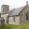
Around 1830 smuggling reached a climax in the Weymouth area, where, it is said; tunnels were constructed from the harbour to merchant’s houses and even to the residence of King George III. The leading figure in smuggling to be connected with Weymouth was Pierre Latour, otherwise known as French Peter, who functioned as a prominent gang-leader in the town. In Wyke Regis churchyard there is a grave of one William Lewis, a smuggler shot dead by a revenue officer on board the schooner Pigmy.

In conclusion, anyone who has anything to do with Dorset will know of Thomas Hardy, the well-known novelist-poet. Less well known is that Hardy was an authority on smuggling – and not without good reason. His birthplace cottage at Highter Bockhampton was actually a capacious safehouse for smuggled contraband that could accommodate up to 80 casks of brandy. “But this isn’tall.” When a child, Hardy was regaled with smuggling stories from his grandfather and his own father had a manservant who was actually involved in the trade. The Bockhampton cottage lay on the smugglers route between Osmington Mills and their markets in Sherborne and Yeovil.

Wimborne to 1800 – A Brief History

There is no certainty whether the site of Wimborne, the historic Minster town of Dorset, had any pre-cursor before the Saxon period. The town occupies a rather strategic position on the floodplain of the convergent rivers Stour and Allen, a situation of quick flooding and drying as the rivers rise and subside. But the Allen had long protected and restricted urban development eastwards.

Although it did not originate as a Saxon Burgh with the status of Bridport or Wareham, Wimborne has nevertheless been a significant royal manor since the 8th century AD. Early in that century King Ina (or Ine) of the West Saxons (688-726) founded the bishopric of Sherborne and appointed St. Aldhelm as its first bishop. In 705, Ina’s sister Cuthberga founded a nunnery on the site, which then became a monastic order for men as well as women. Both Cuthberga and her sister Quinberga – credited with being the co-founders of the town – were buried there.

The term ‘Minster’ occurs in other Dorset place names and can signify both a group of churches founded by King Ina to support a bishopric, and a monastic abbey church. Wimborne first appears as a Minster in 871. The nunnery was sacked and destroyed by invading Danes in 1013, but in 1043 Edward the Confessor founded a college of secular canons on the site. The collegiate building has not survived, but some of the fabric of the late Saxon church (i.e. the Minster) is preserved in the transepts and crossing. For centuries the church retained a special status as a royal free chapel independent of the bishop.

At Doomesday in 1086 Wimborne was held by Queen Matilda as lands of the King, and fell within the 32-hide Hundred of Badbury. But it was the Earl of Gloucester (the future King John) who granted the Minster a charter. The Minster then underwent phases of extensive re-ordering and enlargement in 12th, 13th and 14th centuries. Two developments in the 15th century were the addition of the western tower and a spire to the crossing-tower, though the central tower’s embattled parapet and pinnacles were not added until 1608. The main interior features of interest are the Norman Purbeck Stone font, a 15th century brass to king Ethelred, a medieval astronomical clock and the Chained Library – possibly the earliest public library anywhere.

Like other religious foundations Wimborne attracted settlement of population, though its site was less spectacular than that of Shaftesbury or Corfe. By 1200 a market and fair to be held on St. Cuthberga’s Day (August 31st) was in existence. Originally this was held in the churchyard but in 1244 it was compelled to move onto open space now partly occupied by the present Cornmarket, just west of the Minster. This market was the property of the Deanery Manor and provided the church with an income from stallholders. Further streets would later grow up around the Cornmarket, which also held the stocks for public punishments.

The church/market area then provided the focus around which the town developed in the form of what can be identified as three distinct boroughs or areas. Essentially the area to the north of the Minster and its grounds developed as two boroughs laid out along the axis of what would be called East Street and West Street. Here was centered the first commercial activity in the town. This development was established by the de Lacy’s, Lords of Kingston Lacy, who may have set up a market while the Deanery was without Royal support. But the long streets of East and West Boroughs were not laid out as a natural development from the town centre; rather, their origin is in a rival market set up in opposition to the Deanery.

This market was the borough manor market of the de Lacy’s, which had its own court, and it is recorded that this manor was involved in a dispute with the manor of the Dean in 1236. The noted Dorset historian John Hutchins mentions that there were already burgage tenure properties and evidence of stalls by very early in the 13th century, so indicating the appearance of the Boroughs as a northerly appendage to the ecclesiastical hub. Then about 1300 John de Lacy’s son Henry staked a claim to hold a fair once a year with a weekly market on Sunday and Monday.

The part of the East Borough leading into the Square was originally a narrow winding street crowded with buildings and known as Black Lane. The area of the square was once occupied by a chapel called St. Peters, which was later demolished. The area of the High Street where it bends sharply just east of the Minster, was called Cheapside, though many other street names of the earlier Wimborne are now lost.

The third area of growth centered on a meadow just south west of the Minster long recorded on maps as The Leaze and belonging to Deans Court. This area lies between the Minster and the Stour, and superficially appeared not to have been developed. However, it had been noted that a lane branching from King Street grades into a holloway before ending abruptly some distance from the river, suggesting some main street access to a former residential area. Interestingly, this was indeed confirmed by excavations between 1961 and 1964, revealing the presence of streets and the platforms of houses or cottages extending to the Stour’s floodplain boundary. This evidence dated The Leaze as a borough to around 1200, but it was apparently abandoned by the mid 14th century.

The Black Death did much to halt any further expansion of the town by 1350, and this decease is likely to have been the cause of the desertion of The Leaze. Leprosy was also widespread in the district and a building was dedicated to St. Margaret as a hospital for lepers. In 1800 a document, seemingly to date from King John’s time, was discovered in a chest in St. Margaret’s Almhouses, which superceded the hospital on the site, stating that it was a building for the welfare of lepers.

In 1496 the Countess of Richmond and mother of Henry VII, Lady Margaret Beaufort, founded the grammar school which Elizabeth I re-endowed and which was re-named after her in 1562. Another parchment deed exists endowing a school in Wimborne in 1510, though churchwarden’s accounts at the Reformation indicate trouble and expense in the maintaining of this institution. The governors were then accused by royal commissioners of allowing the building to fall into dis-repair.

Poet Matthew Prior is believed to have been born in Priors Walk in 1664. Wimborne had an unenviable reputation for uncleanliness until 1800, by which time the town had largely been rebuilt. In 1758 the Market House opened in the Cornmarket. The first regular coach service from London to reach here started in 1772, when the fare was £1.4s for the 14-hour journey. In more recent times the smuggler Isaac Gulliver and writer Thomas Hardy lived in Wimborne for a time and it is believed that the memorial to Gulliver in the Minster was the inspiration for the characters Snodgrass and Wardell in the Pickwick Papers. By the 19th century the parish covered 12,000 acres.

In 1915 Canon Fletcher and a doctor, Sir Kaye Le Flem, were sorting archive documents in the Minster library when they stumbled upon hitherto lost churchwardens accounts for 1403 and 1475. The documents revealed that at the time they were written the people of Wimborne were paying rent to the church as the landlords of the property they occupied, as well as burial fees.