Dorset Ancestors Rotating Header Image

Dorchester – No Dignity in Death

There were some in the 18 and 19th centuries who explored the notion that criminals shared common physical characteristics: the study of phrenology was in its early stages but it was thought a person’s features or expressions were an indication of their personality. During this period it was not unusual for casts to be made of the heads of executed criminals in furtherance of these ideas.

In the middle years of the 19th century the Dorchester Gaol employed the services of Dr. John Good as its prison surgeon. Dr Good is known to have applied for licences to make casts of the heads of some executed prisoners, although it is not clear why as there are no records to suggest he had any particular interest in phrenology or physiognomy.

In the 1960’s four casts were offered to the Dorset County Museum and as far we know they remain in store there. Dr John Good practiced from 48 High West Street, Dorchester, and when he retired his son William Good took over and was joined by a partner, Gerald Taylor. Dr Taylor later moved to Icen House, Icen Way, Dorchester. The four casts moved with him and resided in the garage of Icen House until either Dr Taylor or an associate offered them to the museum.

In a paper published in 2000 G.A. Chester, having sifted through all the available documentary evidence and newspaper reports then carefully considering all that is known about the characteristics of the persons hanged at Dorchester between 1833 and 1887, makes a compelling case for the casts being from the heads of: Charles Fooks; Edwin Alfred Preedy; Jonah Detheridge and Thomas Ratcliffe. (See our story ‘The Prisoner a Padre Befriended’ published 9th February 2010 in the Real Lives Category).

A note made by Thomas Hardy dated 9th of September 1888 provides more information about the making of the casts: “T. Voss used to take casts of heads of executed convicts. He took those of Preedy and Stone. Dan Pouncy held the heads while it was being done. Voss oiled the faces, and took them in halves, afterwards making casts from the masks. There was a groove where the rope went, and Voss saw a little blood in the case of Stone, where the skin had been broken – not in Preedys.” In his account Hardy has confused Stone, who was the victim, with Fooks, who killed Stone.

Thomas Haviland Voss (1806-1889) of Durngate Street, Dorchester was listed in directories as a builder and a plasterer. After his death the Dorset County Chronicle published an obituary on the 3rd of October 1889 saying: “Dorchester has just lost its oldest tradesmen in the person of Mr Thomas Haviland Voss. The deceased who belonged to an old and much respected Dorchester family whose connection with the town extended considerably over a century was in business himself for more than half-a-century as a plasterer, &c, from which he retired some years ago.” Thomas Voss’ grandson, Harold Lionel Voss, was reputed to be Thomas Hardy’s favourite chauffeur.

There are no records of casts being made of the heads of any other criminals executed at Dorchester. We know the casts were made under the supervision of Dr Good but we can only wonder about why he wanted them.

Stock Gaylard

For two centuries the estate, the major feature at Stock Gaylard, has been used for country pursuits and sports; the hedgerows and woodlands have been retained for these activities and areas within the estate have been designated as Sites of Special Scientific Interest by English Nature. The estate overall amounts to some 1,700 acres of which 300 acres are woodland with another 80 acres of common land and an enclosed deer park of similar size. The estate is also involved with commercial dairy farming. Five miles to the west of Sturminster Newton the parish is, for administrative purposes, now a part of Lydlinch.
 
Stock Gaylard House appears to date from the early 18th century and is believed to have been built in 1714 when the estate was owned by the Lewys family. It has two storeys with cellars and attics. There was an earlier house but it is not clear where on the estate it stood. Around 1790 when the owner was John Berkley Burland MP, the house was enlarged and improved. During the 19th century further improvements were made by the Yeatman family.

A short distance from the house is the 18th century Twofords Bridge, which carries the main Sherborne to Blandford road over the River Lydden.

The church, which is dedicated to St. Barnabas, stands in the park area of the estate and close to Stock Gaylard House in the north-west corner of the parish. It was rebuilt on the site of an earlier church in 1884, by the Yeatman family in memory of Harry Farr and Emma Yeatman, his wife.

The walls of the church are built of squared rubble with ashlar dressings and the roofs are stone-slated. In the Gothic style it has a chancel, nave, south porch and a bell-cote at the west end of the building. Signs of the earlier church are to be found in the chancel, where there is a restored medieval doorway. In the nave, on the north and south walls, are 16th century windows; the south doorway is medieval and at the centre of the gabled west wall is a restored window thought to date to the 15th century, as does the font. The two bells in the bell-cote over the west gable are from the 13th and 15th century; the earlier bell has a narrow pear shaped form.

Inside the church there are memorials to members of the Lewys and Yeatman families as well as several others dating to the 18th century. Of particular interest is an effigy in Ham stone of the late 13th century, beneath a recessed Gothic arch on the south side of the nave. The recumbent knight (thought to be Sir Ingelramus de Walys) is in mail armour; a plain shield hangs from the left shoulder, the legs are crossed and the right hand rests on the pommel of a sword with spurred feet on couched lion.

There is a memorial to a more recent warrior, Captain Farr Yeatman. He died in 1917 near Jerusalem, where he lies in the military cemetery.  The bronze relief is by Henry Pegram and shows the Captain lying in uniform with his sword. The inscription tells us he gave his life to save another.

Muckleford Treasure Trove

Within the parish of Bradford Peverell is the hamlet and manor of Muckleford, which in 1935 comprised two farms: Higher and Lower Muckleford. The farm-house at Lower Muckleford owned then by Mr Lewis Marsh is interesting being formerly a ‘cell’ dependent on the Cistercian Abbey of Tyrone in Normandy, which was endowed by the De Port family who were lords of the manor during the reigns of Henry I and Stephen (1100-1154.)

In 1935 a very valuable ‘find’ was unearthed when some calves disturbed the soil on Higher Muckleford farm, which was then owned my Mr Chell. The calves’ actions exposed a hoard of gold-coins. Altogether there were over 100 coins consisting mainly of “units” but there were several “half-units” and a few “quarter-units”. These had been minted at various times during the reigns of James I and Charles I (1603-1649). The coins had been packed into a “stocking-purse” that had long since decayed but had been fastened at the neck by silver “four-wire” and a plain purse ring, which we understand Mr Chell later occasionally wore as a finger ring.

At an inquest held at Dorchester on this treasure trove Mr Chell was allowed its full value from the British Museum where most of the coins are but some were presented by Mr Chell to the Dorset County Museum.

It is likely the coins were hidden during the Civil War (1642-1649), probably by a Royalist prevented from returning to recover his treasure through fear of being captured by Parliamentarian soldiers.

Monkton Wyld

Hidden away in the wooded hills and valleys about three miles north of Lyme Regis on the border with Devon is the area of Monkton Wyld. The land here was once owned by the monks of Forde Abbey (Monkton means “of the monks”). Wyld is from the Old English word ‘wil’ meaning a ‘wile’ or a ‘trick’ and is probably a reference to a trap – the cover afforded by the woodland makes for a landscape favoured by poachers. In bye-gone days this was a manor.

Work started on the church in 1848 and although it was consecrated in 1850 the 120 foot spire was not completed until 1856, a year after its architect, Richard Cromwell Carpenter, died. The Church is dedicated to St. Andrew. Carpenter was a member of the Cambridge Movement who revered the decorated Gothic style and claimed it was the only style suitable to the worship of God. This theory became known as Ecclesiology and St Andrew’s is an excellent example of the style, which accentuates the beauty of holiness, the saints and religious symbolism.

Entrance to the church grounds is through a lynch-gate and a yew tree lined pathway leads to the south porch, which is of wood with open sides and decorated with small columns. The church is built of flint with dressings of Caen stone. Unusually, we find a chancel inside with a painted ceiling that is almost as long as the nave and set apart from the side aisles by three bay arcades. There is a central tower topped with a 120 foot-high spire, supported by Gothic arches.
 
The wooden decorated rood screen, its brass gates, the brass communion rail and the choir stalls, were all added by the Revd. John Brook Maher Camm, the third incumbent. There is a beautiful oak pulpit with a base of Mansfield stone and Devon marble, and a painted organ of 1872. In 1875 five excellent stained glass windows by G.E. Cook and Powell’s of London were installed.

The expense of  building the church as well as a rectory, school and schoolmaster’s house, was borne by Mrs Elizabeth Dodson (1798-1883). She was the widow of Charles Phillip Dodson of Stainly Hall, Yorkshire. Mrs Dodson’s only surviving child, her daughter Frances, was married to the Revd. Robert Sparke Hutchings, who was appointed the first incumbent at Monkton Wyld.

There is a story that explains the unusual name of Hutching’s successor, The Revd. Lester Lester. It seems this gentleman was left a legacy but there was a condition attached to the inheritance: he must change his name to Lester. Being uncertain about whether he was to change his given name or his surname he decided to play it safe and change both his names.

This is a thinly populated area made up of farms but with no central village community. It is difficult to see the need for a church here even in the mid-19th century, but those were days when rich landowners and farmers could instruct their employees to support the church. Nowadays, the church is usually locked and you will have to ask for the key to enjoy its interesting interior.

Durdle Door – a lesson in the natural world’s awesome forces.

It must be one of the most remarkable and intriguing formations of the Jurassic coast. Indeed, so curious and intriguing a natural phenomenon that it has been photographed and reproduced as a living-room landscape picture, one reproduction of which hangs above the mantelpiece in the home of a person of my acquaintance.
 
But Durdle Door, on the Dorset coast about a mile west of Lulworth Cove, is actually not unique as an example of a geological feature of its type around the thousands of miles of mainland Britain’s coastline. Rather, it represents a process similar to an earlier stage in the formation of sea stacks, those columnar outliers off headlands of bedded rock, examples of which include the Needles off nearby Isle of Wight, and Orkney’s Old Man of Hoy. “Door”, of course, needs no explanation, but the name “Durdle” derives from the Old English Thirl, meaning a bore or drill.

An appropriate starting point for the origin of Durdle Door would be around 140 million years ago during the late Jurassic period, when a shallow, warm sea was just beginning to retreat from southern Britain, leaving behind a lake basin which basked in an equatorial climate. The sea left behind a calcareous deposit which would later become the Portland Limestone series, but the lacustrine environment which succeeded it occupied the area that is now south-east England – but extending west to include Dorset of course – into which the sedimentary deposits of the Purbeck Beds were the first to be laid down. Around this lake tropical ferns and coniferous plants would have flourished and in and around the water dinosaurs would have roamed (saurian footprints have been discovered in a Purbeck quarry).

Without any marked change in the environment the Purbeck beds graded into a series of clays and sands marking the beginning of the Cretaceous period. These were the Wealden beds and Lower Cretaceous Gault Clay and Greensand. Eventually the sea encroached upon the land again, resulting in the deposition, first of a sequence of sands and clays then the unique lime-rich conditions in which the chalk was formed. But how did this sequence of beds come to be where they are today?

In a programme a few years ago devoted to Dorset in the ITV 1 series Countrywise, a geologist astonished presenter Paul Heiney when he explained how Durdle Door came to be formed. He told Heiney that the feature had resulted when the northward-drifting continental plate of Africa collided with that of Europe! In the immediate collision zone, the impact produced the Alps and the Pyrennees, but it also sent a shock wave of compressional movement extending as far north as Britain. This was powerful enough to tilt the earlier Jurassic and Cretaceous strata of southern England almost vertical.

At Durdle Bay nearly all of the limestone has long been removed by wave-action, while the remainder forms the facing of a small headland. This limestone band also forms the submarine “threshold” and seaward cusps of Lulworth Cove, which has been eeked out by wave action on the softer stata behind in a similar way to that of Durdle Bay. It is possible that the “door” was originally a local lens of weaker or softer strata within the limestone which the sea could breach more readily, so forming the archway. Evidently the sea was then able to erode away the rock behind, leaving a gap providing access to beds forming the headland.

Beyond the upstanding limestone it is noticeable that the top of the headland that joins the limestone to the Chalk is not level. From the ground it can be seen that the beds form a col or depression which then passes up into the Chalk forming the cliff-face of the bay behind. This rock, the sequence of the Purbeck beds overlain by the Wealden Beds and Greensand, was less resistant to erosion than the limestone. The dominant rock type in the Purbeck beds is the Purbeck Marble, a calcareous rock consisting almost entirely of brackish or freshwater snails and which has been extensively quarried as a decorative building stone. Interestingly, another feature of the Purbeck is the preservation of stumps originally belonging to some of those tree-ferns that used to grow around 140 million years ago. These can be seen weathered out in The Fossil Forest to the east of the entrance to Lulworth Cove.
 
Today Durdle Door is under the private ownership of the Weld family as part of their administration of the Lulworth estate. UNESCO teams have for some time been working to conserve the arch and adjoining beach.

Winterbourne Steepleton

About four miles west of Dorchester is the parish of Winterbourne Steepleton, its 1,800 acres laid out in a rectangular plan across the wooded valley of South Winterborne. The village is the original and only settlement in the parish and is found beside the River Winterbourne, which starts its journey in the neighbouring parish of Winterbourne Abbas.  The several thatched cottages in the village date from the 16th, 17th and 18th centuries; throughout the parish there are prehistoric burial barrows, not uncommon in this area west of the county town.

The walls of the parish church, dedicated to St. Michael, are built mostly from Portland rubble with some Ham Hill dressings; the roofs are slate covered. The quoins at three corners of the nave have survived from the church that was here in Saxon times. The nave was rebuilt in the 12th century and there are fragments of wall paintings on the north wall. There is a blocked-up Norman doorway and a Norman west window that now looks into the tower; this was added in the 14th century and houses one late medieval bell. The south porch is also of the 14th century. Although the chancel was rebuilt during the 15th century, the chancel arch was not rebuilt until the 18th century and Hutchins tells us of a 15th century North Chapel that was demolished in 1688. There is a west gallery that bears the date 1708.

The Altar in the chancel is of the 12th or 13th century and has five consecration crosses. The font has a circular Bath Stone bowl with cable ornament at top, moulded arcade of segmental arches below; springing, alternately, from shafted pilasters and corbels of the late 12th century with a stem of Purbeck marble, cylindrical with four shafts and moulded base on square plinth of the 13th century. The modern pulpit has Jacobean panelling.

Of special interest and the churches greatest treasure is a sculpture of an archangel having his waist bound with chains and looking back at his flowing garments; his feet are raised as he flies along and he appears to be holding a skull in his hands. This is an ancient figure of the Archangel Michael and is similar to the angel in the Saxon church at Bradford-on-Avon. Pevsner dates this to the 10th century and says it would have been one of a pair but the RCHM has it from the first half of the 11th century.

The Mill and Millhouse are close to the church and are of the 17th century, though rebuilt and extended in the 18th century. The Manor House is not as old as it appears. It was built about 1870 on the site of a former house that belonged to the Lawrence family and nearby is Manor Cottage. This charming thatched property was built in the 16th century.

In the autumn of 2007 scaffolding went up around the medieval spire of St. Michael’s church; an inspection of the spire found the top seven courses of stonework would have to be removed and re-laid.  The cost was a heavy burden on a small parish but with some grant aid including £6,000 from the Dorset Historic Churches Trust the money needed for the repairs was raised and the work completed in 2008.

Ansty Brewery – the Early Days

Until the late 18th century Ansty was much as it is today, a quiet hamlet within the parish of Hilton but from then until the early years of the 20th century it was a place of industry. In 1777 Charles Hall, a young man just a quarter century in years, started brewing here on a commercial scale. The business continues to this day.

Charles Hall was baptised at Hilton on the 20th of December 1752, the son of William and Deborah Hall. He was a farmer’s son and he learnt about brewing from his father, who was known to do a little brewing to meet the needs of his family, his labourers and other villagers but Charles was a shrewd business man and saw the opportunity to put the family brewing on to a business footing while at the same time keeping an interest in farming.
 
Because he used the best equipment available the business flourished. Substantial government contracts were secured for the supply of beer to the military. This was a time when there were large numbers of troops stationed along the Dorset coast to allay fears of an invasion by the French during the Napoleonic wars.
 
On the death of Charles Hall the business was continued by his son Robert, who never married. However, he did adopt a grand-daughter of his father and this girl married George Edward Illingworth Woodhouse who had been Robert’s head brewer and who later became a partner in the business, which became known as Hall and Woodhouse. In 1875 George Woodhouse passed the business on to his two sons, George Edward Woodhouse and Alfred Charles Woodhouse. The business grew rapidly under their leadership and in 1882 they purchased the business of John Hector and Company of Blandford, who owned several licensed public houses. From this point the breweries at Ansty and Blandford were run as one business.

The beers were produced from barleys grown locally at Cheselbourne and Piddletrenthide; the hops came from Kent and water was taken from a spring on Melcombe Horsey Hill, supplemented by water pumped from the Devils Brook that ran through the brewery site.

At Ansty there was a large brew house, the first floor being used as a mashing room and copper-house. At one end, fixed on a gallery, was the malt hopper and mill, over which was the reservoir for storing the brewing water. On the side of this building back-heated by copper steam coils, was a hot-liquor tank. The mashing machine was the best available at the time. On the floor were two oak mash tuns both fitted with slotted gun-metal draining plates. A large copper holding fifty barrels stood near the mash-tuns; it was heated by fire to which the wort was delivered by a three –throw pump. Also in this room was an iron hop-back fitted with slotted iron draining plates and from here, by means of a two-throw pump, the wort was delivered to the open cooler. Under an adjoining room was a vertical refrigerator, cooling at the rate of thirty barrels an hour.

The hop store was located behind the malting house and held 600 pockets. Off the brew house was a fermenting room where there were eight fermenting tuns fitted with attemporators and chutes. Each of these held sixty barrels.
In 1856 a large vat house was built onto the fermenting house and this contained six vats made of oak, each holding 260 barrels and all used to store and mature old beers.   Adjoining this was another vat cellar holding eleven vats and in front of this was the goods outwards stage. There was another vat cellar containing a further eight vats each containing 116 barrels and there was also a cask drying cellar with a cask-washing department, cooperage etc.
 
Brewing ceased at Ansty in the early 20th century, when brewing was transferred to the Blandford Brewery and Ansty became a distribution centre for the company. The malt houses remained in use until about 1940.

The company provided a lot of jobs locally: there were clerks, maltsters, coopers, barrel washers, an engine driver who doubled as a rat catcher, an Excise Officer, carters, pony boys, a mason, and a wheelwright; also on the payroll were stockmen and a shepherd. At one time the company employed twenty horses and had a number of carts, drays and other vehicles including a ‘tilted’ van and the brewery had its own fire engine.

Ansty has returned to being a peaceful hamlet where some of the old brewery buildings have been converted into houses, flats and a village hall, while the business, still family owned, continues and thrives at Blandford.

Jack Counter V.C.

There was something very special about the presentation Peter Collins of St Helier Galleries made to Advocate Richard Falle of La Societe Jersiase at St Helier Museum in March 1989. It was a bar of military medals including a conspicuous Victoria Cross which Mr Collins, acting on behalf of Mr Falle, had just bid £12,000 for at a London auction house. The VC had returned to the home of the remarkable and courageous serviceman who had won it 71 years before.

But Jack Thomas Counter, the original holder of the decorations, was no native to the Channel Islands. In fact he was born in Blandford Forum on the 3rd of November, 1898 to Frank and Rosina Counter. After leaving school in his teens, Jack found a job at International Stores, a retailing business in the town. When war broke out in 1914 Counter, possibly too young then to serve, joined the action after the introduction of conscription as a private in the 1st Battalion of the King’s Liverpool Regiment in February, 1917. Posted to France, he served with his battalion, which had become engaged with the Germans at Boisleux St Marc.

On 16th April, 1918 Counter’s company faced an enemy breakout, making it critical for a reconnaissance detachment to be sent across the line to gather intelligence. A detail of five other men went out, but all were killed in full view of Jack Counter, who then volunteered to go alone after the decision was made that a lone runner would stand a better chance of surviving to report back. Thus facing almost certain death under enemy fire Counter achieved the objective of returning with the information, enabling his commanding officer to launch a new offensive to recover the regiment’s lost ground.

This alone was an outstanding act of selfless courage, but Jack Counter went on to carry no fewer than five other messages to company HQ across the battlefield under heavy artillery fire. It was following the last of these assignments that he was awarded the Victoria Cross, an occasion reported in the London Gazette of May 23rd, 1918. On the 28th of June, following his investiture by King George V, he returned home to a hero’s welcome at Blandford station, being met by the town’s Mayor, its Corporation and, it seemed, almost the entire population as a tumultuous crowd. Blandford’s Band led Counter and the welcoming party to the market square in an open landau, where Counter was made the very first Freeman of the Borough and presented with a magnanimous War savings certificate and a gold watch, a gift from his employers at International Stores.

While still in the army Counter was promoted to Corporal, a rank, friends were told, he only accepted to avoid the indignity of spud-bashing. Certainly he never contemplated making the army his profession. On being demobbed in the Channel Islands in 1922 he decided to settle and make his home there, soon finding a job as an auxiliary postman at St Ouen, Jersey.

Three years later however, he was seconded to the Post Office at Sudbury Common, Middlesex, remaining there until 1929, when he returned to St. Helier to fill the position of the town’s postman. This work continued throughout the occupation of the Channel Islands by the Germans in World War 2, by which time Jack had met and married a local Jersey woman and by her had a daughter. While still working as a postman, Counter was further awarded the Imperial Service Medal. He would remain in Jersey for the rest of his working life.

The war over, Counter retired from the postal service on April 11, 1959, although he worked for some years more for two local businesses, G.D. Laurens and R Le Ball & Co. During the years of his retirement he returned to visit the family home in Blandford’s Dorset Street several times.

Of course as an ex-serviceman it was natural that Jack Counter should join the Jersey branch of the British Legion, in his case as member 499 in 1930. Yet it was typical of this war hero that he would not be content with a mere passive supporting role out of respect for fallen comrades. He took an active part in the British Legion’s administration as a general committee member, during which time he often joined in games of tombola and housey-housey at social evenings organised at the Hotel de L’Europe.

But to the Jersey public he was a proud soldier who bore the Kings, later Queens. Standard at Armistice Day and other Legion parades. Counter also relished being in the colour-party, carrying the Sovereign’s colour in the presentation of the Festival of Remembrance. For this involvement, Counter even became known as Jersey’s VC.

Throughout his life Jack Counter was by nature a person of ever-cheery demeanour and kindly words. Former Blandford Town Clerk and Freeman Charles Lavington recalls Jack as shy and unassuming – possibly the most unlikely character credentials for a future VC holder. The many friends he made in St. Helier could attest that he was modest and jovial, a leading light in the Jersey British Legion.

But despite his valiant early years the happiness of his twilight ones were shattered by two dreadful blows. The first came in 1964 when his much-loved daughter – his only child – died before reaching middle age. Then only six years later his wife died, leaving him sole survivor of the family he created, and isolated by sea on an offshore state miles from his native county. Now alone, Jack’s nearest kin were a sister-in-law in Blandford and a sister (Mrs Gertrude Weeks) and niece living in Bristol, with whom he maintained contact through occasional visits.

Jack Counter was making one such holiday visit to his sister and niece in Bristol in September 1970, only months after the death of his wife earlier that year. After a few days together brother and sister made a day-trip to visit Jack’s sister-in-law in Blandford. Later that afternoon, when one or both women were out of the room making tea, Jack suddenly collapsed – within an hour of being about to leave to catch the return coach to Bristol. A doctor was called to the Dorset Street home, but found the 71-year-old war veteran-hero to be dead.

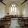
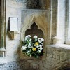
For the two towns of Blandford and St Helier the emerging news was devastating. Jack Counter was taken to Bournemouth for cremation, his ashes then being taken back to St. Helier, where a memorial service was held in St. Andrews Church, First Tower. A plaque put to his memory near the church war memorial reads:

To the Glorious Memory of Jack Counter VC, from his Friends and Comrades in the British Legion, 1970″

Nor were these the only tributes. Within a year of his death Counter was even portrayed on a postage stamp: to commemorate its half-centenary in 1971 the British Legion was honoured with a special issue of four from the Jersey Post Office, including one depicting the veteran with his VC. Just five years later in 1976, when the site of the former Seaview and St. Helier Cottages at First Tower were rebuilt as 15 flats for the elderly, the town council named the new development “Jack Counter Close”. Blandford honoured him with a wreath from the British Legion, and a cushioned wreath presented by his family, which were placed at the base of the war memorial in the cemetery.

In  February 1989 Blandford Museum Curator Benjamin Cox, who already held an archive of material on Jack Counter, admitted he would welcome the medal back, but could not ensure the money or security for it. The Kings Liverpool Regimental Secretary, Major Bob Baker, also considered whether to bid for the VC after it was learnt that a Canadian, who had had Counter’s VC and other medals in his collection for some years, was putting them up for auction at Glendinings in London. The Jersey branch of the British Legion were also thought to be likely bidders, but in the end it fell to Richard Falle of La Societe, through his agent, Peter Collins, to make the bid that bought back for Jersey Jack Counter’s medals. Collins, in fact, had only to bid against one other (unknown) person, who stopped bidding at £11,500.

Besides the VC and the Imperial Service Medal, the Bar also carried a British War Medal., Victory Medal, a George VI Coronation Medal (1937) and an Elizabeth II Coronation Medal (1953). No one could or would deny that Jack Counter deserved his VC. He accepted his decoration with alacrity and pride, although there nevertheless remained at the back of his mind the conviction, perhaps even guilt that it should also have been awarded posthumously to five courageous men who didn’t make it – ghost runners now – cut down on the battlefield at Boisleux St Mare that death and glory day in 1918.

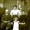
We have posted a photograph of Jack Counter V.C. in the photo section.

Dorset’s Mysterious Stone Circles

Around 1800 BC invaders from the Rhineland settled Britain, bringing with them a pagan tradition that emphasised the importance of stone sanctuaries rather than mere earthworks as foci of old religion ceremonial or ritual. The Beaker Folk as these people were called (after the style of their pottery) left behind many standing stones arranged in rows, avenues, circles, and in isolation, in the highland and lowland regions of the UK. Stonehenge is only the most sophisticated and large-scale of these ceremonial centres, but many far more minor stone circles were constructed.

The Beaker and later Bronze Age people of Dorset left a legacy of about six stone circles, mainly in the south of the county. Some have virtually disappeared while others have been damaged, either through natural erosion or subsidence, or by man’s actions.

About halfway along the B3351 between Corfe and Studland and in the north shadow of the Purbeck Ridge below Nine Barrow Down lies Rempstone. This is the site of a hitherto unknown and ignored stone circle, as it is not shown either on the first OS map of the 1890’s, or even the present Internet Megalith Map. Yet the circle must once have been a complex and impressive one, and Cope mentions it in ‘The Modern Antiquarian’ as being lost in undergrowth, neglected, obscured, and cut by ditches and embankments. The site remained in this condition until 1966 when the enclosing woodland was felled to open it up to the view from the road, and new saplings planted nearby.

Ten stones have been relocated at Rempstone: a few standing, some nearly complete, with others lop-sided or sunk through subsidence. Surveying has found that some of the stones would have stood almost 6 feet high while others would have been less than knee height. Another recorder has noted four stones 4 feet high, and another four large stones fallen. These form a half circle 80 feet across, later sliced in two by a bank and ditch.

To the south the area has largely been cleared, with rocks piled together a short distance to the east. This pile comprises eight identical stones, and it has been suggested this feature could represent the remains of a large outlier subsequently collapsed. The stone nearest to the road is speckled with holes and cracks, which were found to have a number of coins wedged into them. Other stones related to the circle are scattered throughout the present wood.

In 1957 a local farmer ploughing his field half a mile to the west of the main site uncovered 26 stones arranged in two rows to form an avenue three yards wide. This avenue was found to be aligned directly with the circle, and is thought to indicate that the Rempstone Circle has – or had – alignments to mark the autumn and summer equinoxes. Another 23 stones about 2 feet 6 inches long were found in the field immediately south of the B3351, and west of the track from Rempstone Farm. Were these once part of a ceremonial way or a line of sighting to the circle?

Besides being impressive, the Rempstone Circle is also unusual. It was sited along the foot, rather than the summit of a ridge or downland favoured in most other cases, including other sites in Dorset. But it has been pointed out that it would have been in easier reach of the Bronze Age populations both on Nine Barrow Down and living in the Purbeck heath area. Another mystery is that one researcher found unexplained light effects on a photograph of one of the stones which resembled fairies or elemental spirits.

Other Circles. There is a stone circle at a focus of paths on a downland knoll about 1 km south east of Lower Kingston Russell (OS SY577877; Landranger Sheet 194.) This has been described as an unimpressive ring of slabs (assumed to be fallen, as recumbent stone circles are not otherwise known in southern England.) The circle is a scheduled ancient monument, but is not mentioned by Burl in his impressive treatise ‘Stone Circles of Brittany, Ireland and Britain.’ This monument is more impressive from the air, but any further information about it is clearly needed.

Just over 4 km to the NE of the Kingston Circle however, stands the much better known and protected Nine Stones near Winterborne Abbas (SY 661904;LR194.) Owing to its good preservation and situation directly on the south side of the A35, this monument, in the eastern corner of a block of woodland, has been fenced off and gated, though with access to the enclosure.

This circle has very large and very small stones ranging from 90 cm to 3.4 metres, which Burl has suggested may represent sex symbols. Some have also noted some influence of the Caledonian or northern highland circles in the Nine Stones, and small clay objects like elongated dice inscribed with symbols have been found on some of the stones following the summer solstice. This monument, which is in the care of English Heritage and has an information board, is difficult to park nearby. Another location (given as OS SY600900) half a kilometre south of the Nine Stones has been recorded as the site of another small circle since destroyed.

A feature described as a cluster of stones has been recorded under some trees in the corner of a field at Little Mayne (SY 723871;LR194.) This was certainly part of the remains of a once larger feature, as another stone lies in a field to the east (SY 724870.) The stones occur mainly on the north side of the road, with a few on a hedge-line on the south side. Minor stone rows also occur nearby. The Little Mayne stones are described by Peter Knight in Ancient Stones of Dorset.

Considerable megalithic activity seems to have been centred around Portesham, with a stone circle surviving on a spur of the coastal ridgeway only 1 km NW of the village. This circle (SY 596864;LR194) also lies just 2.5 km south east of the Kingston Russell circle, while immediately to the north is the area known as the Valley of Stones. The valley is recorded on the Dorset Monuments Record as a possible prehistoric site with a circle of sarsens, of which one sarsen found a few feet north of the circle had been used to grind axes. However, Jeremy Harte of Dorset Archaeology Unit couldn’t find the stone being mentioned in any literature, so with a colleague he checked it out. While certainly unusual it cannot be stated with certainty if the stone is genuinely prehistoric-placed or not. But it is not thought the Valley of Stones has ever been systematically excavated.

Though actually the exposed cairn of a round barrow, the Hellstone, 1 km north of Portesham, broadly resembles a stone circle (ST 606867;LR194.) On Moynes Down near Upton (SY745836;LR194) there is a cairn of stones less than a metre in height set in a circle about 6 feet across. Another circle is said by Charles Warne in Ancient Dorset (1872) to have stood: “..within living memory between East Lulworth and Povington, but not a vestige remains of it remains.” The story goes that the stones were removed by a farmer to build a stream-bridge and two gateposts!

Pimperne – A Village Fit for a Queen

A village fit for a Queen; so thought Henry VIII. He granted the Manor of Pimperne to his fifth wife Catherine Howard but only for the duration of her life. Henry had a clever head on his shoulders, for after he saw to it that Catherine lost hers, he granted the Manor in 1543 to her successor Catherine Parr, who had the good fortune to survive her husband.

In the late 18th and early 19th centuries villagers could still recall handed down memories of the Queen’s Walk, which apparently wound round the village but by then had long disappeared as had a maze that was famous in its day. Made from banks of earth about a foot high it was said: “It was the delight of the rustics on certain days of the year to thread this labyrinth, which was of a very complex pattern.” John Hutchins tells us the maze was ploughed into the ground in 1730.
 
We often acknowledge our indebtedness to Dorset’s greatest historian, John Hutchins, overlooking that it was his wife Anne, the daughter of the Revd. Thomas Stephens, a rector of Pimperne, who, at considerable risk to her own life, saved her husband’s manuscripts when fire struck at Wareham. (See our story John Hutchins in the Biography Category 13th of January 2010.)
 
Sheltering under an ancient spreading chestnut tree about fifty yards from the church and just outside its gates is the village preaching cross. All that remains of the cross is the lower part of an octagonal shaft set in a square pedestal on a plinth of three steps, the lower step being well worn. All such crosses were ordered by Cromwell to be cut down to the height of a man, though this one is unusually tall. Some sources date the cross to the 14th century but the RCHM says it is: “probably late 15th century.” A soldier of the New Model Army was buried in the churchyard on the 16th of January 1645.

The churchyard is entered through a lynch-gate erected by the Woodhouse family as a memorial commemorating the life of Lieutenant Edward John Woodhouse of the family brewing firm and the Central India Horse, Major Oliver George Woodhouse of the West Kent Regiment who was killed at Dunkirk in 1940 and Colonel Harold Woodhouse, who collapsed and died during an air raid at Blandford Camp in 1943 while serving as Camp Commandant. (See our article Ansty Brewery: The Early Years, in the Hilton Category.)

There has been a church on this site since Saxon times. The present church is dedicated to St. Peter and was rebuilt in 1873-4 at the expense of Viscount Portman of Bryanstone; it incorporates evidence of the earlier building. The 12th century chancel arch has been reset at the north side of the chancel and the Norman south doorway was moved to the west end of the south aisle. In the vestry is a Norman font with beautifully carved flowers and twining stems on its bowl. The date of the conical stone cover is unknown but certainly came later and we are told was found buried in the churchyard. Hutchins records four bells, the oldest dated 1694; a further bell has been added.

Whether or not Henry’s wives spent any time at Pimperne is difficult to say but in view of the distance from London it is unlikely they visited often. The existence of a Queen’s Walk and the arms of Henry VIII in the Rectory suggest that they did visit Pimperne, in which case they would have worshipped at St. Peter’s Church.

The Rectory is a two storey house with tiled roofs and attics built from brick banded with flint. The present building dates from 1712 but incorporates parts of an earlier building of 1530. On a shield within the building is Henry VIII arms with crown, garter, dragon and greyhound supporters and with a rose and portcullis.
 
In a list of rectors since 1299 some noteworthy names appear including: Christopher Pitt who gained some recognition in the 18th century for his translation of the Aeneid; George Bingham, who followed him as rector, who ministered here for 52 years and the Victorian author the Reverend Charles Kingsley, who was curate here in the early 1840’s.  Robert Frampton was born here in 1622 and went on to be Bishop of Gloucester between 1681 and 1691.

The village has been known as Pimperne since 1271, the name is thought to be from the Celtic words pimp and prenn meaning “Five trees”.  Domesday Book tells us of forty families living here in 1086 when the village was surveyed together with Charlton Marshall and Hutchins records 80 families when he surveyed Pimperne.  In more recent times the size of the parish has been increased by boundary changes: the Domesday settlement of Nutsford joined the parish in 1886; land in the south including the manor of Damory Court, mentioned in 1363, was transferred to Pimperne in 1894 and in 1933 small areas of Tarrant Hinton, Launceston and Monkton were taken into Pimperne. The census for 2001 records the population of the parish as being 995 occupying 447 dwellings.

Judging by the size of the Pimperne Long Barrow (330 feet in length and 140 feet wide), there would have been a sizable population here in Neolithic times. From the air a series of crop and soil-marks reveal an area of Iron Age dykes and enclosures. The barrow lies on the Tarrant Hinton side of the parish boundary.

Even after much chopping and changing Henry VIII never did find the right wife. John Williams of Pimperne faired better with his choice of wife and left in the church vestry a brass memorial to her.  It reads: “Near this place lies the body of Mrs Dorothy Williams who deceased Nov. ye 24th Ano Dom 1694. Erected by her husband John Williams Cler. in memory of the best of wives.”